| Yes, that is my rear end downclimbing the slope. Steeper than it looks. |
Showing posts with label Day Hikes. Show all posts
Monday, January 27, 2014
Sunday, January 26, 2014
Tamanwas Falls and A Whole Lotta Ice
Thrilled to take my husband hiking for the first time in a very long time, but dismayed to discover thick sheets of ice over what was supposed to be an easy trail. I gave Dr B my microspikes, which rendered him impervious, and then tried not to plunge off a cliff in my trailrunners or break my coccyx on the ice. Once home, we toasted to proper gear for both us next time if we're to continue this "couples" hiking thing.
Monday, July 8, 2013
Kendall Katwalk, PCT, Snoqualmie Pass
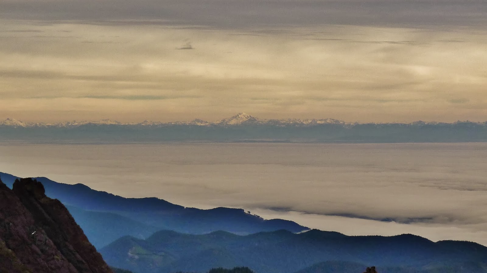
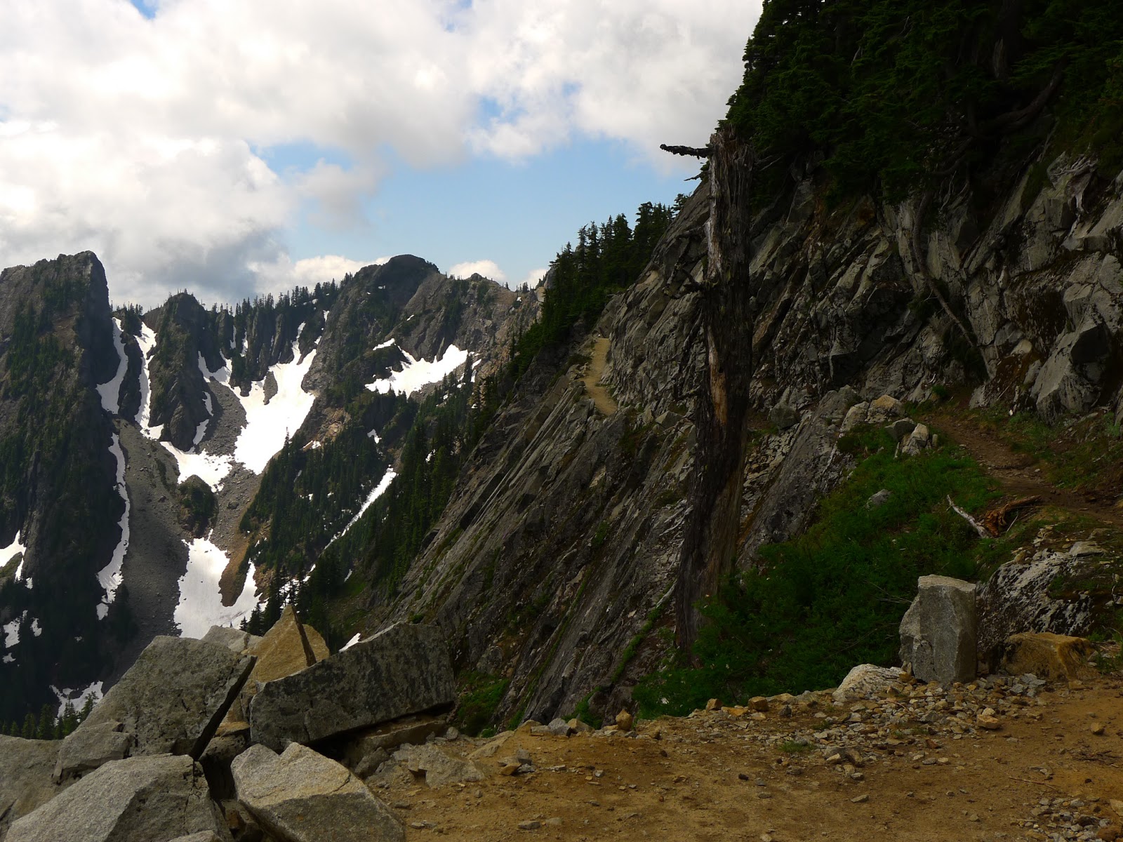
This morning I drove to Snoqualmie Pass to check out the conditions at Kendall Katwalk. It's still close to four hours to drive there from Portland, but I-90 is really pretty. The PCT trailhead is easy to find, and the route to the catwalk is fairly idiot-proof. I am not a huge fan of foresty hikes, instead preferring meadows, rocks and sky, but the forested majority of this hike is about as lovely as trees and moss get. After a couple miles, the views start opening up as you switchback up talus slopes, and the terrain is varied the entire way with tallish peaks all around. On a Monday morning, I passed only one other hiker and two coming out (at the top and on the return trip there were many more). There were still a few snow slopes as I approached the ridge, but they were soft and manageable in trail runners and utilizing poles. Only one of the traverses raised my pulse a little, but it was over quickly. I passed the little scramble up to Kendall Peak and saw some bear prints in the snow. After another short stretch, I reached the catwalk at about six miles, a touch further than I had read. Mount Stuart was visible in the distance, my new mountain crush. The cloud-enshrouded panoramic view is empirically very pretty, but I was slightly underwhelmed... guess I'm spoiled. The trail between me and Bumblebee Pass looked very snow-drifted, so I opted out. I trail-ran down the way I came, busting my ass in a waterfall once, and then battled traffic for over five hours. Is this worth a loony drive, à la Mount Aix and others? The jury's still out until I get a damn nap.
12.5 miles out and back.
Monday, July 1, 2013
Mount Aix Hike
Wonderful alpine hike east of Mount Rainier with two new hiking buddies. Mount Aix is the highest point between Goat Rocks and Mount Daniel, and from its top you have in-your-face views of Rainier, Helens, Adams and Goat Rocks, as well as the neighboring 7,000+ foot peaks in the Nelson Ridge group and the distant Stuart Range. The drive is 3 hours 45 mins from Portland in the early morning, but (irritatingly) closer to 5 on the way home (tourist traffic). Totally worth it, even with the five miles of switchbacks up to the ridge. We saw goats on Fake Bismarck (the un-named peak blocking the view of Bismarck), encountered little snow,and generally had an awesome time. One of our party scrambled up the class three summit block, while my partner and I stayed just below. We explored the class two route up the back, but it seemed unappealingly long and also somewhat sketchy. Both approaches had their drawbacks, and we decided that we were not missing out by playing it safe. Excellent hike with excellent people.
Subscribe to:
Posts (Atom)


