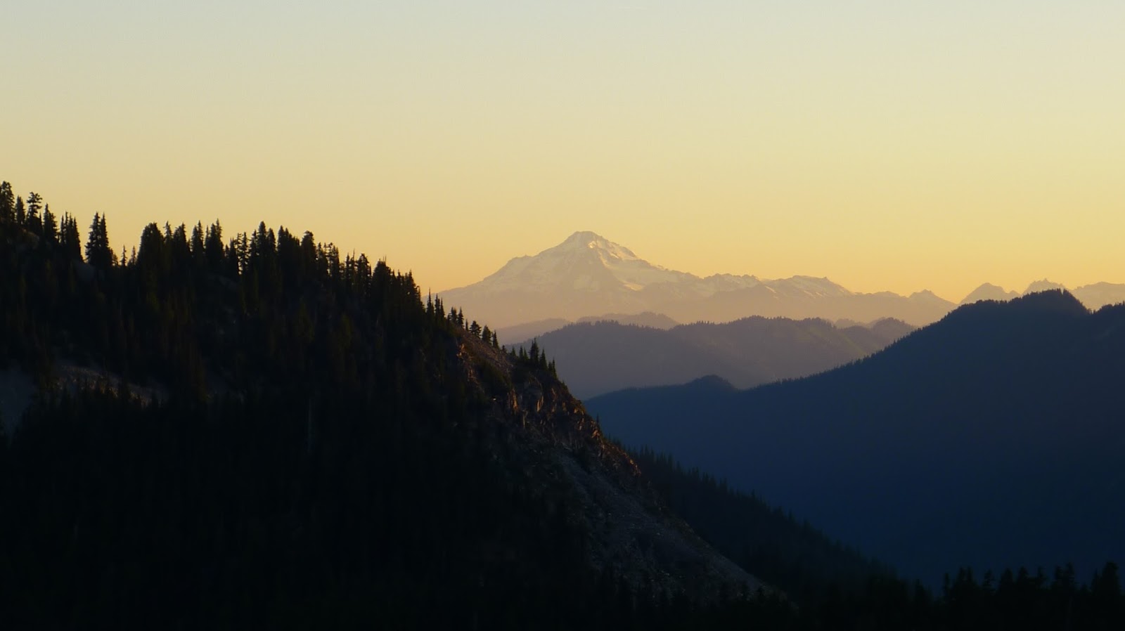
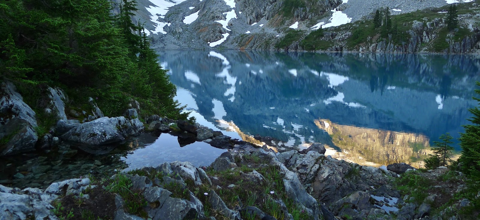
Jade Lake is one of those places where words are fairly inadequate, so I'll keep this short. From Portland to Salmon LaSac in the pre-dawn hours it's four hours. From the junction at Salmon La Sac to Tucquala Meadows it's 10 miles but 45 minutes, and that's in an SUV. The road is so bad that a passenger car would have to travel even slower. The Scatter Creek car ford is currently at about 9 inches in depth. The trailhead is a large parking area in beautiful meadow in a canyon. Starting out the trail is quite flat, with two miles of shaded gentle ascent to Hyas Lake, which is basically a large, pretty greenish pool in the Cle Elum River, with Cathedral Rock high above and eventually views of the massive east flanks of Mount Daniel. At 4 miles you pass the Tuck/Robin Lakes junction, and shortly after the trail steepens significantly as you climb towards Deception Pass. At the pass, which is really just a big trail junction in the forest, take the Marmot Lake branch. From there, the trail drops and climbs for 3.5 miles through overgrown, buggy Hozzbizz Basin, which is a mix of marsh and meadow. The trail is not pleasant here, despite glimpses of Glacier Peak off towards Stevens Pass, at least until the next junction with Lake Clarice. The sign for the junction is about 10 feet down the trail and easy to miss, but take the left branch at the Y. From there, it's .5 miles of climbing to Marmot Lake. At the pretty but buggy lake, you'll pass a double campsite right away on a rock up high as you head clockwise around the lake (about 30 minutes), and several more closer to the water past that. From the first set of campsites, you can see the gully up to Jade Lake. Work your way around the lake, staying close to the shore most of the time on a trail that sometimes becomes hard to follow, until you reach the second large rock field. There are a couple small ones, but look back towards that first campsite - if you can't see it, you're not at the right gully. You'll know for sure you're on the right path when you see cairns marking the way. A couple of them have pink tape on them. Follow them all the way up (about 1-1.5 hours), primarily staying on a faint bootpath through the heather on the far left side of the rockfield, until you reach the meadows of No-Name and finally Jade Lake. We didn't have time to make the climb to Dip Top Gap, but I will be back in the not-too-distant future.


2 days, 18 miles RT
* Credit to Julie for the New Motto of the Summer


Jade had a totally different color when we went, it was more pea-soup green. Is it because that was later in the season?
ReplyDeleteBeautiful photos, thanks for taking me back...I might have to return to Jade soon.
I want to go back and hit up Diptop Gap, let me know if you want to team up.
ReplyDeleteI actually thought the same thing about the water - it looked more like Pea Soup or Blanca. Still stunning, but not "jade." Didn't love the overgrown buggy part between Deception and Marmot, but otherwise awesome.
Damn. Just...damn.
ReplyDeleteWord.
ReplyDeleteQuite an adventure ... the lake more turquoise blue than jade, but still striking !!
ReplyDeleteQuite an adventure ... the lake more turquoise blue than jade, but still striking !! -Nancy
ReplyDeleteLet me know when you want to go back! smultringunn (@) gmail.com
ReplyDeleteAbsolutely will!
ReplyDelete